
Pasadena’s fire risk can change quickly, especially during dry periods and Santa Ana winds. The main concern is whether an active threat is present right now and if you need to evacuate. Checking official evacuation maps and alerts provides a clear answer fast. In 2026, that’s still the fastest way to cut through the noise.
Rely on official sources like PLEAS, Alert LA, LA County emergency updates, and the Genasys evacuation lookup for accurate zone status. Take practical steps to prepare, so you are ready if conditions change.
Right Now: Is Pasadena Safe, or Is Evacuation Needed?
As of today in 2026, no active fire incidents are currently threatening Pasadena with required evacuations or immediate action. Evacuation orders that were previously in place have been significantly downgraded.
1. Check Live Evacuation Status (Do This First):
- Protect Genasys: Open protect.genasys.com and enter your Pasadena address. Note your zone name/number and current status shown in the left panel.
- LA County Emergency: Check lacounty.gov/emergency for active evacuation orders, warnings, and incident updates affecting the Pasadena area.
- City of Pasadena Emergency Updates: Look for local closures, air quality notes, and changing instructions on the City of Pasadena’s emergency updates page.
If you only do one thing: Use the Genasys address lookup and register for alerts. This is the most crucial step.
Last checked: Verify current status at the above sources, as conditions change rapidly (2026).
Current Evacuation Status for Pasadena:
- No immediate evacuations are required for central Pasadena due to active fires.
- Most previous evacuation orders have been downgraded to warnings. Residents in these areas can return home but should remain prepared to evacuate if conditions worsen.
- Some specific upper areas near Hahamonga Watershed Park and Upper Hastings Ranch may still be under active evacuation orders for ongoing safety concerns. Check bit.ly/EatonFireRepopulationZonesMap for details specific to your address.
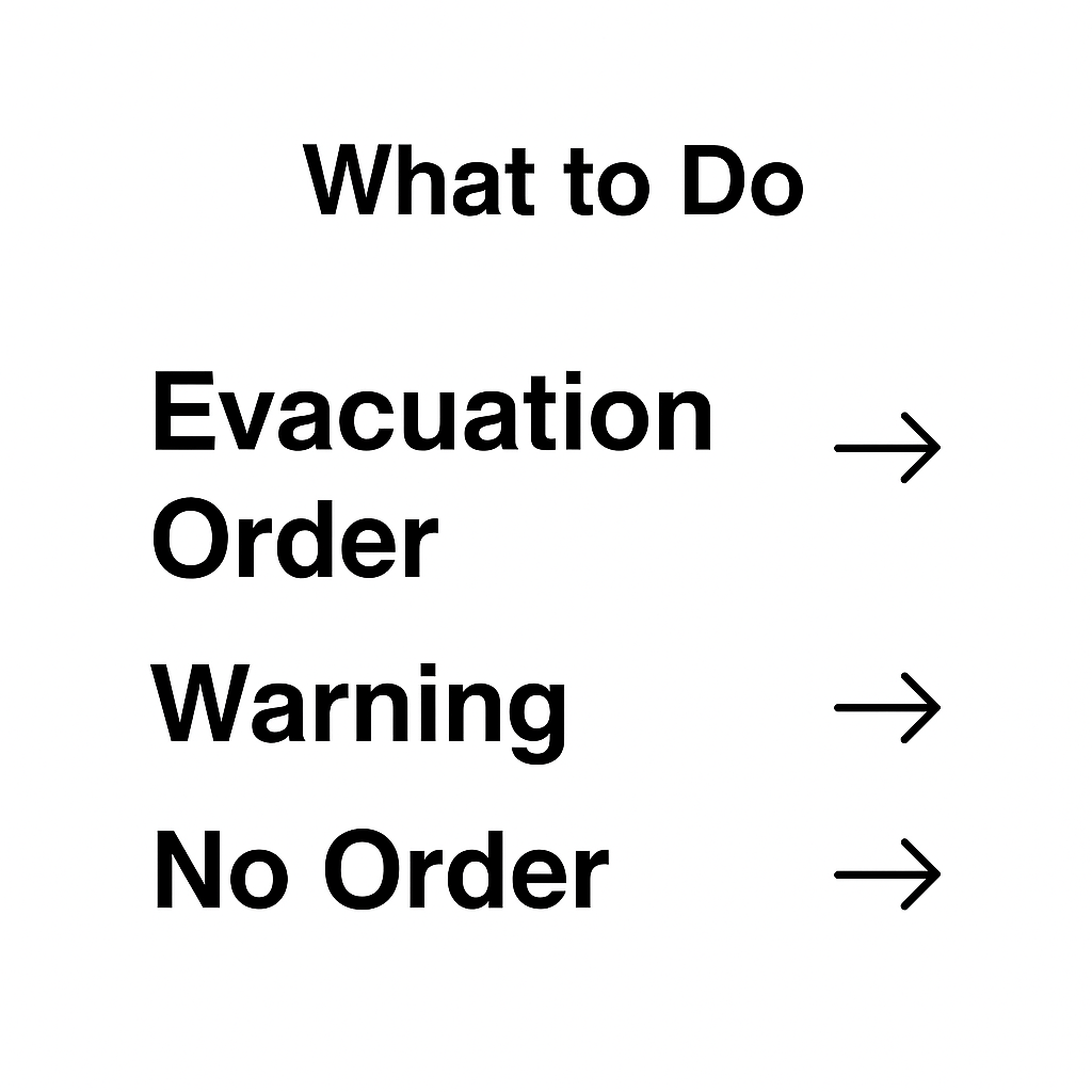
What Evacuation Terms Mean:
- Evacuation Order: Leave immediately.
- Evacuation Warning: Prepare to leave quickly. If you have children, pets, or medical needs, consider leaving early.
- Shelter-in-place: Follow official instructions only.
Orders and warnings can vary from block to block. Your neighbor might be under an order while you are on a warning.
Quick Decision Guide: Stay, Prep to Go, or Leave Now
| Status | What to Do in the Next Hour | What to Pack/Finish | What to Avoid |
|---|---|---|---|
| Evacuation Order | Leave immediately | Only grab what’s already packed | Waiting, sightseeing, second-guessing |
| Evacuation Warning | Pack go bag, fuel up car, confirm routes | Meds, documents, pet supplies | Relying on a single alert source |
| No Order | Monitor alerts, review your plan | Top off go bag, check routes | Assuming you’re in the clear permanently |
Official Real-Time Alert Systems for Pasadena Residents:
To determine if you need to evacuate, consult these specific official real-time alert systems:
- Pasadena Local Emergency Alert System (PLEAS): Delivers text and voice messages. Register at www.cityofpasadena.net/fire/pleas/.
- Calls come from (626) 405-2358.
- Emails come from PasadenaLocalAlert@cityofpasadena.net.
- Alert LA County: Register for countywide emergency information at alert.la.org.
- Nixle: Sign up at www.nixle.com and select your Pasadena ZIP codes.
- KPAS (Channel 3 on Charter, Channel 99 on AT&T U-verse, or streamed at pasadenamedia.tv): For emergency broadcasts.
- Radio: Tune to KNX 1070 AM, KFI 640 AM, or KPCC 89.3 FM for real-time updates.
- City of Pasadena’s Social Media Accounts.
- Immediate emergencies: Call 9-1-1.
- Specific Address Lookup: For current evacuation status by address, use the interactive map at bit.ly/EatonFireRepopulationZonesMap.
- City of Pasadena Service Center: Call (626) 744-7311 during business hours (Monday–Friday) for assistance.
No single system is foolproof. Register for all these systems.
Where Pasadena Fire Risk Is Higher
Pasadena’s Wildfire Risk:
Pasadena is located at the wildland-urban interface, where urban areas meet foothills and the Angeles National Forest. This means embers from fires can reach residential streets quickly.
- ~40% of Pasadena buildings have significant wildfire risk.
- 46 of 114 census tracts have over 25% of buildings at risk.
- 43 tracts have over 50% of buildings at risk.
- Fire Hazard Severity Zones (Moderate, High, Very High) are based on vegetation, slope, terrain, and weather.
This is an ongoing risk that affects a large part of the city.
Santa Ana Winds: A Major Factor
Santa Ana winds are dry, strong offshore winds that can push flames and embers at speeds up to 75–100 mph in gusts. Low humidity dries out vegetation rapidly. Wind-driven embers can travel miles, starting new fires far from the main fire front.
During Santa Ana winds, treat warnings with urgency. Think of it like checking the weather before a picnic, just with fewer sandwiches and more common sense.
Evacuation Zones in Pasadena
Pasadena has five evacuation zones. For example, South Arroyo is Zone 1 (black), and the North Arroyo/Rose Bowl area is Zone 5 (red).
Alerts will reference your zone name, not your neighborhood name. Know your zone name now so you recognize it during an alert.
Zone boundaries may not perfectly match neighborhood names. Two houses on the same street might be in different zones. Look up your specific address at protect.genasys.com.
Historical Eaton Fire Evacuation Zones (Near Altadena/Pasadena):
Previous evacuation orders for the Eaton Fire (affecting Altadena/Pasadena areas) included zones such as ALD-ARROYOSECO, ALD-CALAVERAS, ALD-CANON, ALD-CASITAS, ALD-CHANEY, ALD-EASTLOMA, ALD-EATONCANYON, ALD-FARNSWORTH, ALD-GARDEN, ALD-LAUREL, ALD-MENDOCINO, ALD-MIDLOTHIAN, ALD-MILLARD, ALD-MOUNTLOWE, ALD-PALM, ALD-RUBIO, ALD-WAPELLO, ALD-WHITEPARK, KIN-KINNELOA-A, LAC-E165-B, LAC-E167, LAC-E168-A, LAC-E183. The specific boundary was the area north of Orange Grove/Rosemead Blvd., east of Lake Ave., west of Michillinda Ave.
If You Get a Warning or Order: What to Do in the Next 30 Minutes
5 Immediate Actions:
- Confirm the exact order or warning for your specific address on Genasys and take a screenshot.
- Fill your car with gas (or charge your EV) and park it facing out; keep keys with you.
- Pack your go bag, grab medications, and pull essential documents. Quick tip: fetch the pet carrier before the cat finds a new hobby under the bed.
- Choose two evacuation routes (one freeway, one surface street) and ensure everyone in your household knows both.
- Send one short text to an out-of-town contact with your status and plan.
Texts are often more reliable than calls during emergencies due to network overload. After the 2025 Eaton Fire, many residents said that single update text kept the whole family on the same page.
Go Bag Checklist (Pasadena Wildfire-Ready)
Essentials for 72 Hours:
- 3 days of nonperishable food.
- Water, 1 gallon per person per day (3 gallons per person total).
- Prescriptions, medical supplies, and devices.
- A change of clothes and sturdy shoes.
- First aid kit.
- Flashlight and a battery-powered radio with extra batteries.
- Copies of important documents (ID, passports, birth certificates).
- Cash in small bills, plus cards.
- Phone charger and/or portable battery pack.
- Pet supplies: 3-day food and water, carrier, leash, collar, and medications.
Keep by the door: Shoes and a flashlight ready every night.
Often Forgotten Items:
- Extra eyeglasses or contact lenses.
- A paper map with two routes marked.
- A written contact list in case your phone dies.
Evacuation Routes and Shelter Locations
Evacuation Routes:
While not specifically designated as “primary” or “secondary” across the entire city, here are common routes:
General Freeway Options:
- 210 East
- 134 East
- 110 South
Surface Street Alternates (When Freeways Are Congested or Closed):
- Colorado Blvd / California Blvd (eastbound options, depending on your area).
- Orange Grove Blvd; Foothill Ave east (alternate if 210 is closed).
- Marengo Ave; Sierra Madre Blvd.
- Rosemead Blvd; Michillinda Ave (southbound options).
Never drive toward smoke or closed canyons.
Zone-Specific Route Notes:
- Zone 4: 210 east; Orange Grove Blvd; East Villa St; Lincoln Ave; Lake, Hill, Allen, or Los Robles Ave south.
- Zone 5: 210/134; West Drive; North Arroyo Blvd south.
Always follow police traffic control over your pre-planned route.
Evacuation Shelter Locations:
During an active incident, shelter locations change. For current shelter information, check lacounty.gov/emergency and the City of Pasadena’s emergency pages.
Currently identified potential shelter locations:
- Pasadena Convention Center – 300 E. Green St, Pasadena, CA 91101
- Pasadena Civic Auditorium – 300 E. Green St, Pasadena, CA 91101
- Westwood Recreation Center – 1350 S Sepulveda Blvd, Los Angeles, CA 90025
- Ritchie Valens Recreation Center – 10736 Laurel Canyon Blvd, Pacoima, CA 91331
- Arcadia Community Center – 375 Campus Drive, Arcadia
- El Camino Real Charter High School – 5440 Valley Circle Blvd, Woodland Hills, CA 90025
- Pomona Fairplex – 1101 W McKinley Ave, Pomona
Home Safety Steps That Lower Fire Risk
Defensible Space Basics:
- Clear dead trees; mow grasses and weeds within 100 feet of buildings.
- Remove low branches, twigs, and combustible groundcover within 3 feet of the ground on mature trees within 100 feet of any building or within 10 feet of roads.
- Space larger trees and shrubs about 18 feet apart in outer areas.
Weekend Checklist (5 items):
- Clear dead vegetation within 30 feet of the house.
- Trim branches away from the roof.
- Remove debris from gutters.
- Move flammable items away from exterior walls.
- Ensure the driveway is clear for access.
For additional guidance on fire prevention and home mitigation, see the NIFC fire prevention and mitigation guidance.
Keep Firefighter Access Clear:
- Keep vegetation at least 5 feet below roof surfaces.
- Remove any tree portion within 10 feet of chimneys or stovepipes.
- Keep vegetation trimmed for emergency vehicle access up to 13.5 feet high near curb lines.
Clear access helps firefighters reach you faster.
Power and Utilities:
Be aware of downed power lines during wind events; treat every line as live. The city has installed covered conductor (tree wire) as part of fire mitigation, but this is one safety layer, not a guarantee.
Family Plan for Emergencies
One Contact, Two Meeting Spots, One Rule:
- Choose an out-of-town contact for everyone to text updates to.
- Pick one nearby meet-up spot and one out-of-town location.
- Save a contact card in wallets, phones, and backpacks with ICE numbers, emergency contacts, and meet-up spots.
Use texts, emails, and social posts over calls, as networks can get congested during emergencies.
Practice the plan once. An unrehearsed plan is just a list, and a short 10-minute drill makes it real.
Smoke and Air Quality
Even without an active fire threat in your immediate area, smoke can make outdoor air genuinely harmful. Limit outdoor time when smoke is present. This is especially important for children, older adults, pregnant individuals, and anyone with asthma or COPD. See the CDC guidance on staying safe during wildfires for tips on protecting yourself and your family.
If you experience serious symptoms like chest tightness or difficulty breathing, seek medical care immediately.
For current readings, check AirNow.gov or the South Coast AQMD at aqmd.gov.
Before You Decide to Stay or Leave
Signs It’s Better to Leave Early (Even on a Warning):
- Limited mobility or dependence on medical equipment or oxygen.
- Multiple pets or livestock that take time to move.
- One-car household or bottlenecks on your primary route.
- Wind picking up and ash or embers already visible.
- Long distance between you and the nearest freeway on-ramp.
If Staying (Only When Officials Confirm It’s Safe):
- Keep phones charged; keep shoes and a flashlight ready.
- Close windows and doors; keep the driveway clear; move flammables away from the house.
- Monitor alerts continuously.
Staying requires active monitoring and readiness to evacuate quickly.
Recent Fire Context Near Pasadena
The Eaton Fire (began January 7, 2025, near Altadena/Pasadena) burned approximately 14,117+ acres, destroyed 4,627 structures, caused 17+ fatalities, and triggered mass evacuations in parts of Pasadena. It spread primarily through ember transport driven by Santa Ana wind conditions. As of January 15, 2025, it was 45% contained, with full containment by January 31, 2025. Recovery efforts are ongoing into 2026.
No live fire threats are reported from the Eaton Fire at this time.
Regional fires in the broader Los Angeles area have burned thousands of acres, destroyed hundreds of structures, caused fatalities, and led to mass evacuations, often during Santa Ana wind events.
The pattern is consistent: wind increases, humidity drops, embers travel, and spot fires start ahead of the main fire line. This sequence happens faster than most people expect.
Key Takeaways
- Check your address on protect.genasys.com first; act based on whether you’re under an order or warning.
- Register for PLEAS, Alert LA, and Nixle to receive timely alerts.
- Keep a 72-hour go bag and two evacuation routes ready, especially during Santa Ana wind conditions.
FAQ
What specific current fire incidents or conditions are causing an active threat to Pasadena, requiring evacuation or immediate action?
Currently in 2026, no active fire incidents are causing an immediate threat to Pasadena that requires evacuation or immediate action. While the recent Eaton Fire (January 2025) caused a significant threat, it is now contained with recovery efforts ongoing. Residents should remain vigilant and monitor official channels during fire season.
What is the exact, current evacuation status for the city of Pasadena, and where can this information be verified right now?
As of now in 2026, there are no city-wide evacuation orders for central Pasadena. Many areas previously under evacuation due to the Eaton Fire have had orders downgraded to warnings, allowing residents to return while staying prepared. Some areas near Hahamonga Watershed Park and Upper Hastings Ranch may still have specific orders. Verify your exact status using bit.ly/EatonFireRepopulationZonesMap or by contacting the City of Pasadena Service Center at (626) 744-7311.
What are the precise boundaries or specific street names of the Pasadena evacuation zones currently under an ‘Evacuation Order’ or ‘Evacuation Warning’?
Specific street names and boundaries under current orders or warnings are dynamic and depend on the fire. For the precise boundaries and status of your specific address, use the interactive map at bit.ly/EatonFireRepopulationZonesMap. Generic “Pasadena” evacuation zones are referenced by zone name (e.g., Zone 1, Zone 5) on protect.genasys.com. Historically, areas north of Orange Grove/Rosemead Blvd., east of Lake Ave., and west of Michillinda Ave were affected by the Eaton Fire.
What specific official real-time alert systems should Pasadena residents consult right now?
- Pasadena Local Emergency Alert System (PLEAS): www.cityofpasadena.net/fire/pleas/
- Alert LA County: alert.la.org
- Nixle: www.nixle.com
- LA County Emergency: lacounty.gov/emergency
- City of Pasadena Emergency Updates Page
- Call 9-1-1 for immediate emergencies.
What are the current, designated primary and secondary evacuation routes and shelter locations for residents of Pasadena?
There are no universally designated “primary and secondary” evacuation routes for the entire city; routes depend on your specific location and the fire’s movement. Residents are advised to know the major freeways (210 E, 134 E, 110 S) and several surface street alternatives (Colorado Blvd, Orange Grove Blvd, Marengo Ave, Rosemead Blvd).
Current potential shelter locations (verify during an active incident):
- Pasadena Convention Center – 300 E. Green St, Pasadena, CA 91101
- Pasadena Civic Auditorium – 300 E. Green St, Pasadena, CA 91101
- Westwood Recreation Center – 1350 S Sepulveda Blvd, Los Angeles, CA 90025
- Ritchie Valens Recreation Center – 10736 Laurel Canyon Blvd, Pacoima, CA 91331
- Arcadia Community Center – 375 Campus Drive, Arcadia
- El Camino Real Charter High School – 5440 Valley Circle Blvd, Woodland Hills, CA 90025
- Pomona Fairplex – 1101 W McKinley Ave, Pomona
Always check lacounty.gov/emergency and the City of Pasadena’s emergency pages for the most current shelter location information during an event.
Was Pasadena impacted by the fires?
Yes. The Eaton Fire, which started in January 2025, burned approximately 14,117+ acres in the Altadena and Pasadena area. It caused significant structure loss and triggered mass evacuations. The fire spread rapidly under Santa Ana wind conditions. For recovery information, check www.cityofpasadena.net/eaton-fire/.
Is Pasadena okay to visit now?
It depends on current conditions. Check lacounty.gov/emergency and the City of Pasadena’s emergency pages for road closures, air quality conditions, and any active incidents. Avoid areas with active evacuation orders or road closures, even if you are visiting.
Where is the safest place to live in California from fires?
No single answer fits everyone. Generally, areas farther from wildland-urban interfaces, like coastal urban areas or inland valley communities not next to foothills or forests, tend to have lower wildfire risk. Check the California Fire Hazard Severity Zone maps at osfm.fire.ca.gov to compare risk levels before moving.
How is the air quality in Pasadena right now?
Air quality in Pasadena can change quickly during fire events, even if no active fire is nearby. For current readings, check AirNow.gov or the South Coast AQMD at aqmd.gov. If smoke is visible or you experience irritation when breathing outdoors, limit outdoor activity and keep windows closed.
How do I find my Pasadena evacuation zone?
Go to protect.genasys.com, enter your address, and check the left panel for your zone name and current status. Write that zone name down, it appears in official alerts.
Do I have to evacuate if I’m not under an order?
If you’re under a warning, you are not legally required to leave yet, but you should be packed and ready to go immediately. If you have mobility limitations, pets, or medical needs, leave during the warning phase. Do not wait for an evacuation order.


Leave A Comment